

Assam flood satellite tracking operations expanded significantly after authorities launched an advanced flood mitigation initiative using real-time satellite imaging and digital monitoring systems across vulnerable river regions in Assam. The large-scale disaster management project aims to improve flood forecasting, strengthen emergency response coordination, and reduce damage caused by recurring monsoon floods throughout the state. Meanwhile, officials stated that the technology-driven system could transform disaster preparedness strategies across northeastern India.
Bengal Sikkim Tourism Circuit Expands Himalayan Travel
Kolkata Metro Green Line Expands Under River
Advanced Satellite Monitoring System Activated
Authorities confirmed that the flood mitigation program now uses high-resolution satellite imaging, geographic information systems, and live hydrological monitoring technology to track river conditions and flood-prone areas. Additionally, officials explained that the system can provide near real-time environmental data during heavy rainfall and rising water levels.
The monitoring network reportedly focuses on major rivers, low-lying districts, embankment zones, and vulnerable settlements frequently affected during monsoon seasons. Consequently, disaster response agencies may receive faster alerts regarding flood movement and high-risk locations. Earlier, delayed information and limited monitoring systems often complicated emergency evacuation and relief coordination efforts.
Officials from the Assam State Disaster Management Authority stated that the initiative supports long-term climate adaptation and disaster resilience planning. Furthermore, authorities indicated that additional technological upgrades may expand the monitoring network across more districts in future phases.
Real Time Data Strengthens Emergency Response
Senior disaster management officials and technical experts attended operational review meetings connected to the satellite-based flood monitoring initiative. Meanwhile, authorities highlighted the importance of rapid information sharing during large-scale weather emergencies.
Officials explained that real-time imaging allows emergency teams to monitor river expansion, breached embankments, and changing water flow patterns with greater accuracy. Specifically, satellite data may support faster deployment of rescue teams, relief supplies, and evacuation resources during critical flood situations. In addition, climate analysts believe advanced forecasting systems can significantly reduce disaster response delays.
Several disaster management specialists welcomed the project because Assam experiences severe flooding almost every monsoon season. However, environmental experts emphasized that technology alone cannot fully prevent flood-related damage without long-term ecological planning and river management reforms. Despite this, officials confirmed that integrated flood management strategies remain under active development.
Vulnerable Districts Receive Priority Coverage
The Assam flood satellite tracking project reportedly prioritizes districts located near the Brahmaputra River and its tributaries because these areas frequently face severe flooding and erosion. Additionally, authorities confirmed that densely populated flood-prone villages remain central to monitoring operations.
Disaster response planners explained that early warning systems become especially important in remote regions with limited transportation access. As a result, authorities introduced mobile alert systems and district-level coordination centers connected to the satellite monitoring network. Furthermore, officials continue improving communication infrastructure supporting emergency operations.
Flood management experts noted that climate change and unpredictable rainfall patterns increasingly complicate disaster forecasting in northeastern India. Therefore, advanced satellite technology may improve long-term environmental risk assessment and preparedness planning across Assam.
Meanwhile, local residents reportedly expressed optimism regarding faster warnings and better evacuation planning during future flood emergencies. Authorities also stated that awareness campaigns involving schools and village councils may strengthen community preparedness programs.
Artificial Intelligence And Mapping Technology Introduced
Officials confirmed that artificial intelligence-assisted mapping tools and predictive flood models now support the disaster monitoring initiative. Additionally, technical specialists explained that machine learning systems may help identify high-risk flood patterns using historical environmental data.
The Assam flood satellite tracking program also integrates digital terrain analysis and weather forecasting technologies into emergency management operations. Consequently, authorities may improve flood prediction accuracy and resource allocation during crisis situations. Furthermore, researchers continue evaluating advanced climate modeling systems linked to river basin management.
Technology experts stated that satellite analytics and predictive mapping increasingly influence global disaster response strategies. In addition, environmental planners believe digital monitoring systems may strengthen infrastructure planning and climate resilience policies.
Earlier, authorities launched modernization projects involving weather stations, emergency communication systems, and digital disaster response infrastructure. At the same time, policymakers encouraged collaboration between scientific institutions and disaster management agencies.
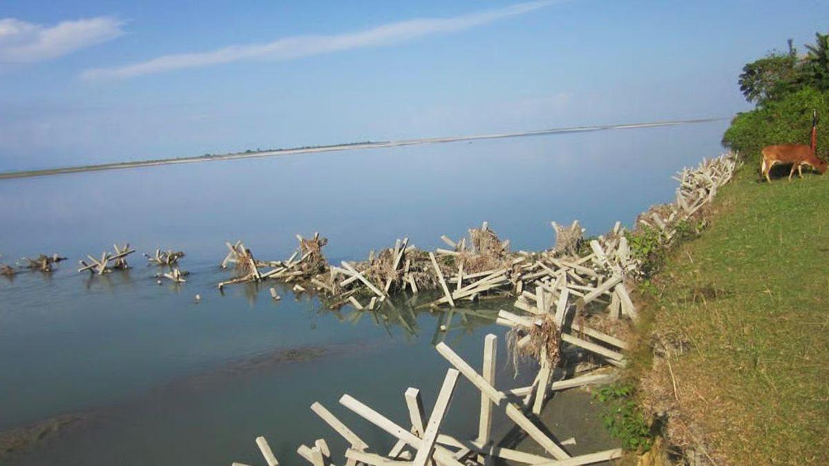
River Erosion And Infrastructure Protection Receive Attention
Authorities explained that the flood mitigation initiative also focuses heavily on riverbank erosion monitoring and embankment protection systems. Specifically, satellite imaging may help engineers detect vulnerable river sections before major structural failures occur.
The Assam flood satellite tracking network reportedly assists authorities in identifying erosion hotspots affecting roads, bridges, farmland, and residential areas. As a result, infrastructure agencies may prioritize repair work and preventive reinforcement measures more effectively. Furthermore, officials introduced proposals involving stronger embankment construction and sustainable river management systems.
Environmental researchers observed that erosion-related displacement continues affecting thousands of families across Assam during recurring flood seasons. Therefore, improved monitoring and infrastructure planning may reduce long-term social and economic disruption.
Meanwhile, agricultural communities welcomed stronger flood forecasting systems because farming operations frequently suffer heavy damage during severe flooding events. Authorities confirmed that coordination with rural development agencies remains ongoing.
International And Scientific Collaboration Expands
Officials stated that scientific institutions and environmental agencies from multiple regions have shown interest in Assam’s satellite-based flood management model. Additionally, climate experts highlighted the importance of technology-driven adaptation strategies for disaster-prone river systems.
The Assam flood satellite tracking initiative reportedly encourages collaboration involving hydrologists, climate scientists, and remote sensing experts. Consequently, future projects may involve expanded climate research and cross-border environmental monitoring systems. Furthermore, academic institutions continue participating in flood data analysis and forecasting studies.
Several international disaster specialists noted that satellite-based monitoring systems increasingly support humanitarian response operations worldwide. In addition, environmental policy experts believe advanced forecasting tools can improve long-term resilience against climate-related disasters.
Meanwhile, community organizations requested continued investment in relief shelters, healthcare access, and rural infrastructure alongside technological upgrades. Authorities responded by indicating that integrated disaster resilience policies remain under consideration.
Future Climate Resilience Planning Continues
Government officials confirmed that additional flood mitigation and environmental monitoring proposals remain under active review across Assam. Specifically, authorities continue evaluating smart river management systems, advanced weather forecasting infrastructure, and climate adaptation strategies.
Experts believe digital disaster monitoring will remain central to future flood management policies in northeastern India. Moreover, satellite technology and predictive analytics may strengthen emergency preparedness and environmental planning nationwide.
The Assam flood satellite tracking initiative represents a major technological advancement in disaster management and climate resilience planning. Ultimately, officials expect the project to improve flood forecasting, strengthen emergency response systems, and reduce environmental risks across vulnerable regions of Assam.
FAQs
What is the Assam flood satellite tracking project?
The project uses advanced satellite imaging and digital monitoring systems to track floods and improve disaster response operations in Assam.
Which rivers are included in the monitoring system?
Authorities are focusing mainly on the Brahmaputra River and connected flood-prone river networks.
Which organization oversees the flood mitigation initiative?
The Assam State Disaster Management Authority coordinates the technology-based disaster monitoring project.
How does satellite imaging help during floods?
Satellite systems provide real-time information regarding river expansion, flooding patterns, and vulnerable infrastructure areas.
Are artificial intelligence tools part of the project?
Yes, authorities confirmed that predictive mapping and AI-assisted flood analysis support emergency planning operations.
What does Assam flood satellite tracking mean for disaster preparedness in India?
Assam flood satellite tracking initiatives may strengthen flood forecasting, climate resilience, and emergency management systems across vulnerable regions.